Challenge 9 of 52: Pedestrian Bridge


Every week, the source of inspiration for the assignment keep changing. I rarely read physical newspapers these days but since my father-in-law regularly buys them so I still stumble upon it. An article few weeks back clearly grabbed my attention.
The headline screams “Need for pedestrian ‘map'” and “Pedestrians fear for safety on deserted bridges”. Furthermore, the image featured shows a familiar sight – the pedestrian bridge that connects from Ampang Park LRT to The Intermark. I saw it every time I exit the LRT to get to the virtual office space at Troika.
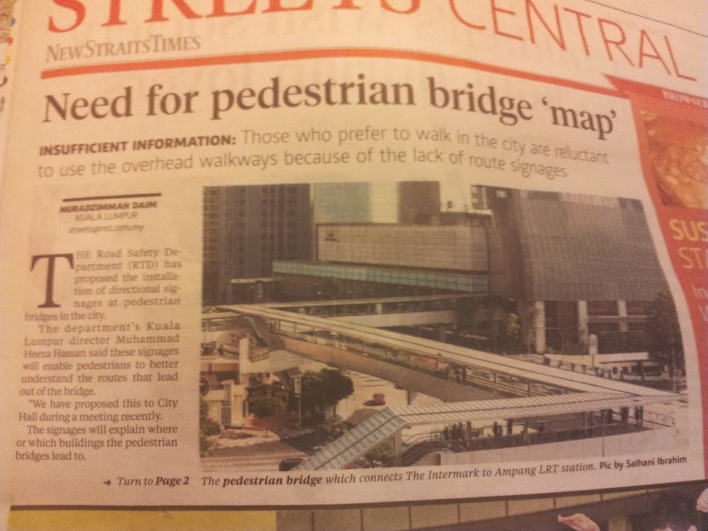
So, let’s address the complaints highlighted in headlines. First, “Need for pedestrian ‘map'”. I don’t know why the journalist put air quotes for pedestrian map. It is a legitimate map, even though it is for pedestrian use and not for drivers
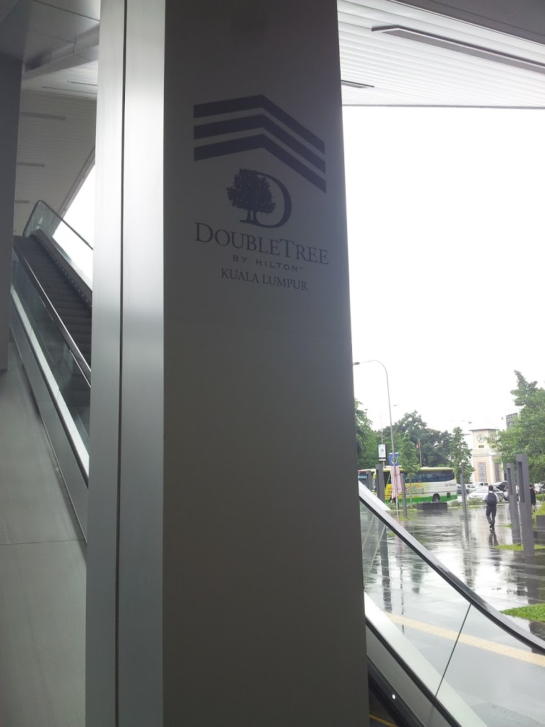
I decided to check out the newly opened Jaya Grocer at The Intermark and buy a head of Iceberg Lettuce. My starting point is the Ampang Park LRT and end at level 2 of The Intermark. There’s a sign pointing to Doubletree by Hilton at the start of the route. Seems good, but unfortunately that’s the lone sign I encounter along the way.

Since I’ve been to The Intermark, it’s not a problem for me to get to the supermarket. After buying the lettuce, I immediately head back to The Troika. There’s no signboard on the way back either. In fact, I saw a tourist asking the security guard for direction.
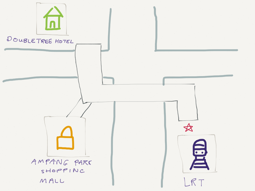
The solution? Well, just draw up a map and print it out! Show the route and the landmarks. Here’s my sketch below.

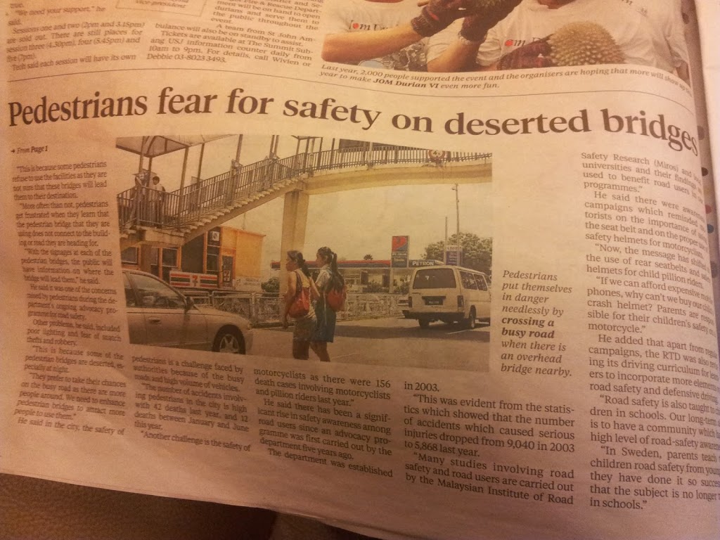
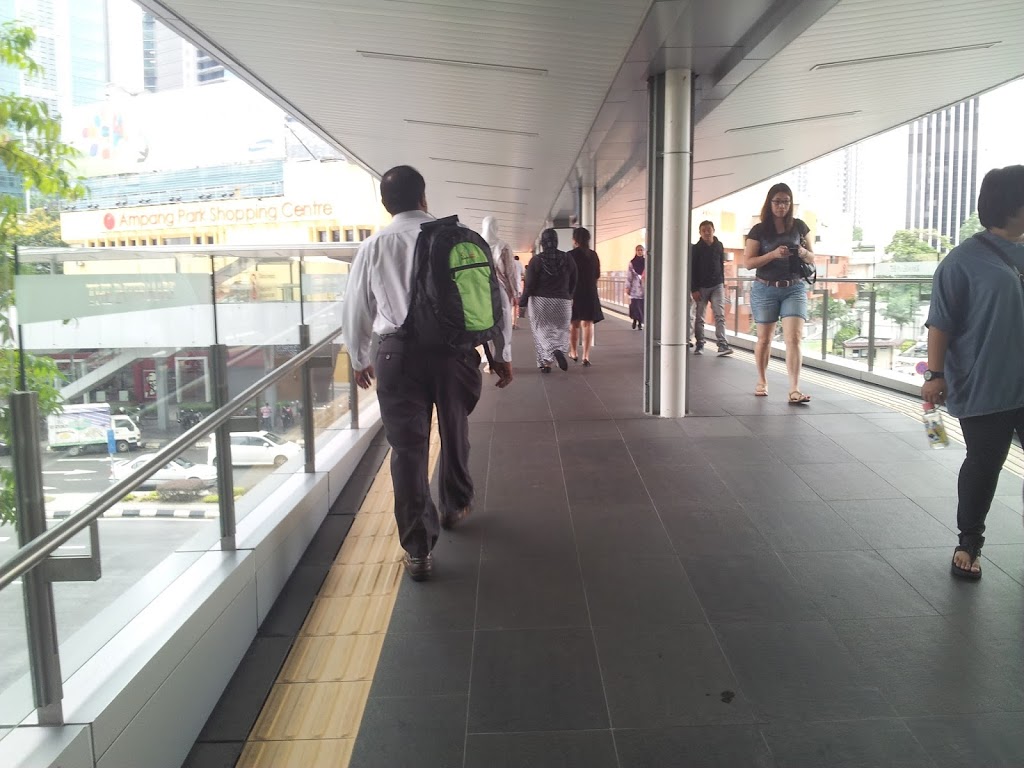
With the first complaint busted, let’s move on to the next one – “Pedestrians fear for safety on deserted bridges”. How deserted is the pedestrian bridge? When I went to the supermarket, there’s hardly any people and I can count them with my fingers. However, on the way back it’s a different scenario as it’s already lunch time. Throngs of workers ply the bridge in both direction to go to eat. There’s definitely good food on both side of the bridge.

| Deserted bridge |
 |
| During lunch hour |
So, the real complaint is that the pedestrian bridge is deserted outside peak hours (eg; start and end of office hours, plus lunch hours). As I stated earlier, there’s already a security guard stationed half way along the route. That helps a bit, but not by much.
 |
| A tourist asking the guard for direction |
What really qualifies as deserted? In the documentary Urbanized, a space of 100m by 100m is the maximum dimension that is comfortable for human cognition. Bigger than that, it is perceived as too wide open and invites a feeling of vulnerability.
The route is L-shaped and each side is roughly 50m long. Thus, it is only 50m by 50m – half (or is quarter?) of the said maximum area. Perhaps, this perception is relative. Compared to other spaces around the bridge it is by far the widest expanse of area.
The solution? One option is to divide the lane with signboards – it can display maps or advertisements. At least it will cut the perception of vastness on one side of pedestrian field of vision and bring it to a more manageable level. A more expensive option is to enclose the bridge with tinted glass similar to the one that link KLCC to Pavilion. It’s a longer route but didn’t feel quite as vulnerable as the Ampang Park – The Intermark route.
I’m looking forward to next week as it will be the 10th challenge. Personally, seeing the number cross over to double digit is a great breakthough. It also meant that I’m almost 20% through.
If you have any product, service or outlet that need some UX insight, I’m glad to offer a free one hour consulting and feature the proposed solution in this blog. Just email me at firdaus.ariff@gmail.com for further info.